Prag 6
Stadtteil von Prag

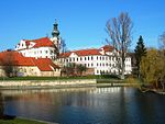
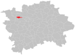
Prag 6 ist ein Verwaltungsbezirk sowie ein Stadtteil der tschechischen Hauptstadt Prag. Der Bezirk liegt am nordwestlichen Rand der Stadt und reicht bis ins historische Zentrum Prags hinein. Auf dem Gebiet liegt der Václav-Havel-Flughafen Prag.
Auszug des Wikipedia-Artikels Prag 6 (Lizenz: CC BY-SA 3.0, Autoren, Bildmaterial).Prag 6
Evropská, Hauptstadt Prag Veleslavín
Geographische Koordinaten (GPS) Adresse In der Umgebung Auf Karte anzeigen
Geographische Koordinaten (GPS)
| Breitengrad | Längengrad |
|---|---|
| N 50.095277777778 ° | E 14.346666666667 ° |
Adresse
Nádraží Veleslavín
Evropská
152 00 Hauptstadt Prag, Veleslavín
Prag, Tschechien
Bei Google Maps öffnen


