Štěrboholy
Ersterwähnung 1399Stadtteil von Prag

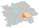
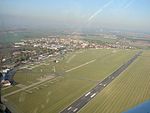
Štěrboholy (deutsch Sterbohol) ist ein Stadtteil und eine Katastralgemeinde der tschechischen Hauptstadt Prag. Štěrboholy gehört zum 15. Verwaltungsbezirk und war ursprünglich eine selbstständige Gemeinde, die 1968 nach Prag eingemeindet wurde. Štěrboholy liegt zwischen zwei Ausfallstraßen nach Kutná Hora und Kolín.
Auszug des Wikipedia-Artikels Štěrboholy (Lizenz: CC BY-SA 3.0, Autoren, Bildmaterial).Štěrboholy
K Učilišti, Hauptstadt Prag Sterbohol
Geographische Koordinaten (GPS) Adresse In der Umgebung Auf Karte anzeigen
Geographische Koordinaten (GPS)
| Breitengrad | Längengrad |
|---|---|
| N 50.072222222222 ° | E 14.549722222222 ° |
Adresse
K Učilišti 174/6
10200 Hauptstadt Prag, Sterbohol
Prag, Tschechien
Bei Google Maps öffnen


