Liverpool City

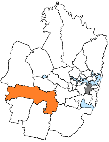
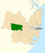
Liverpool City ist ein lokales Verwaltungsgebiet (LGA) im australischen Bundesstaat New South Wales. Liverpool gehört zur Metropole Sydney, der Hauptstadt von New South Wales. Das Gebiet ist 305,7 km² groß und hat etwa 234.000 Einwohner.Liverpool liegt in Outer Sydney etwa 25 bis 50 km westlich des Stadtzentrums. Das Gebiet beinhaltet 44 Stadtteile: Ashcroft, Austral, Busby, Carnes Hill, Cartwright, Casula, Cecil Hills, Chipping Norton, Edmondson Park, Elizabeth Hills, Green Valley, Greendale, Hammondville, Heckenberg, Hinchinbrook, Horningsea Park, Hoxton Park, Len Waters Estate, Liverpool, Lurnea, Middleton Grange, Miller, Morrebank, Pleasure Point, Prestons, Sadleir, Voyager Point, Warwick Farm, Wattle Grove, West Hoxton und Teile von Badgerys Creek, Bonnyrigg, Bringelly, Cecil Park, Cobbitty, Denham Court, Holsworthy, Kemps Creek, Leppington, Luddenham, Mount Pritchard, Rossmore, Silverdale und Wallacia. Der Verwaltungssitz des Councils befindet sich im Stadtteil Liverpool im Nordosten der LGA.
Auszug des Wikipedia-Artikels Liverpool City (Lizenz: CC BY-SA 3.0, Autoren, Bildmaterial).Liverpool City
Hume Highway, Sydney
Geographische Koordinaten (GPS) Adresse In der Umgebung Auf Karte anzeigen
Geographische Koordinaten (GPS)
| Breitengrad | Längengrad |
|---|---|
| N -33.933333333333 ° | E 150.91666666667 ° |
Adresse
Hume Highway
Hume Highway
2170 Sydney
Neusüdwales, Australien
Bei Google Maps öffnen


